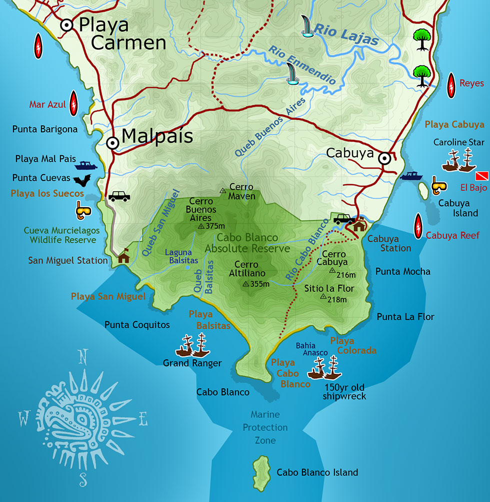
This map was a lot of work, and something I’ve been planning for eight years. I finally put together all the information from many different maps on the internet and a scan of the map from the Costa Rican geographical society, using photoshop, to create this one, which is by far the best and most accurate map on the internet.
If you’re interested in reading the history of the “Grand Ranger” shipwreck that’s shown on this map, click here: Grand Ranger Shipwreck.
If anyone finds any flaws, please let me know and I’ll fix it. Also, I can’t find a map showing the exact location, size, and shape of Cueva Murcielago Wildlife Sanctuary.
To see the same image, as seen by satellite, click here: Cabo Blanco Satellite Photo.