- Home
- Accommodation
- Activities
- Area Info
- Maps
- Photo Galleries
- Real Estate
- Travel
Montezuma Coast Map
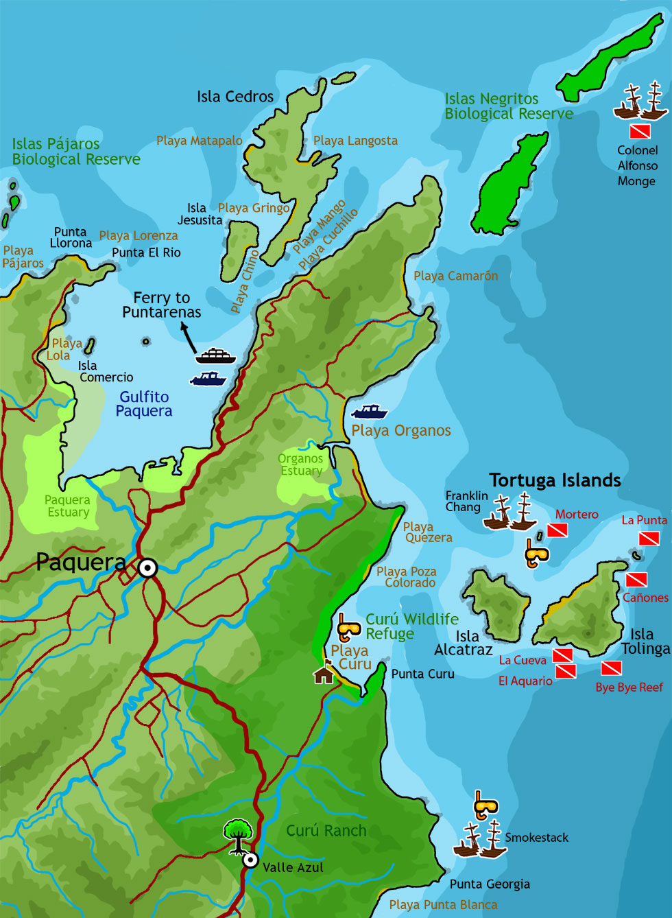
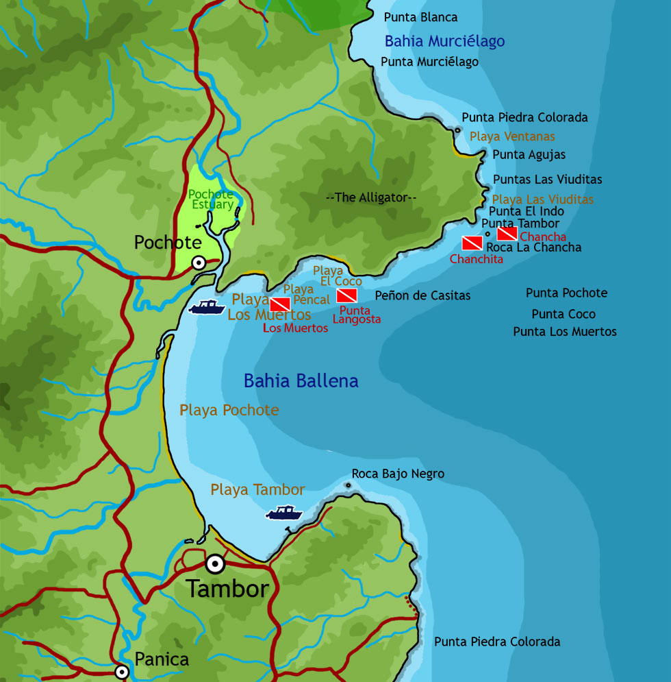
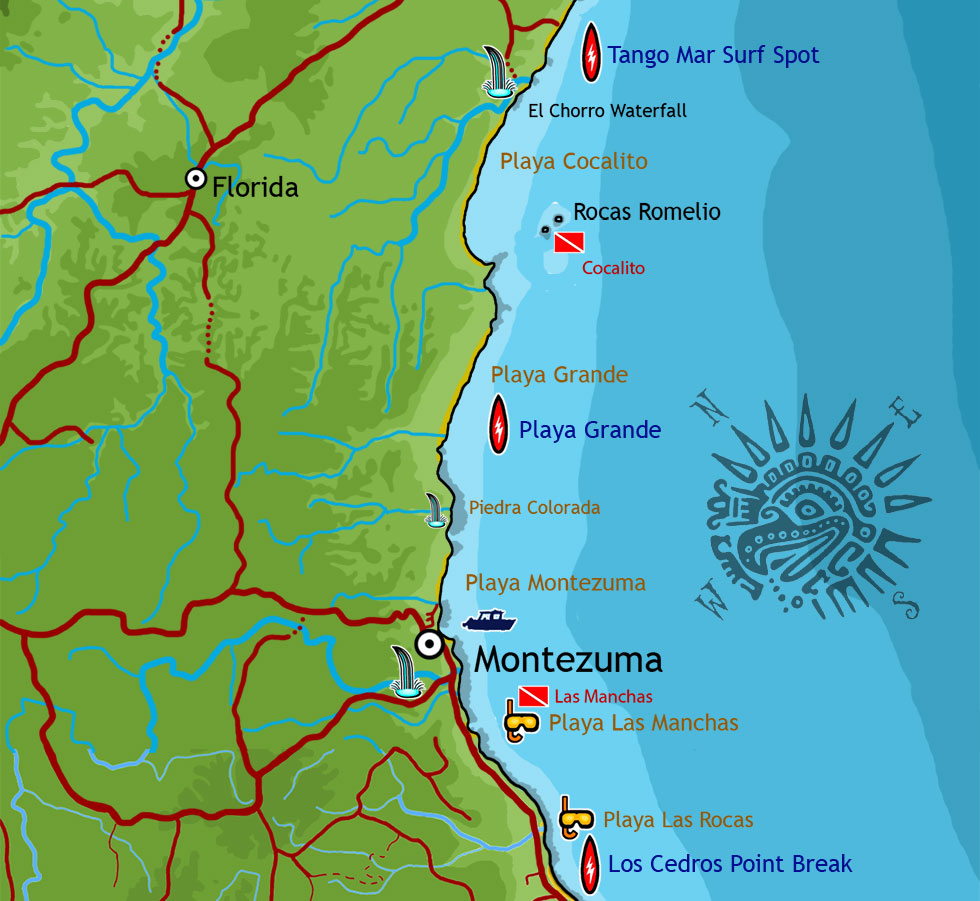
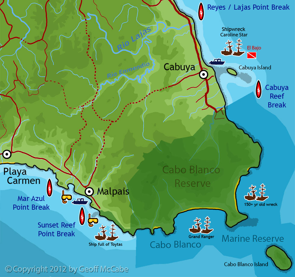
This map shows the coast in Costa Rica from Malpais and Cabuya, going northeast to Montezuma up to Paquera. Most boat tours and scuba diving trips start in Montezuma and head north to the Tortuga Islands, such as the Tortuga Island Adventure Tour will go. The journey takes you past Tambor and Curu Park. If you were to keep going, you could wrap around the point and end up at the Paquera-Puntarenas ferry terminal.
The maps below are in four sections: Paquera/Tortuga, Tambo/Bahia Ballena, Montezuma, Cabuya/Cabo Blanco/Malpais and show most of the available points of interest and activities, including surf spots, scuba diving sites, best snorkeling areas, sandy beaches, and all the known shipwrecks.
Great Stuff

Clandestina Restaurant
My new favorite restaurant, Clandestina is not to be missed by food lovers staying anywhere near to Montezuma. Established in March 2015, Clandestina is the new kid on the block. The Oregon/Tico collaboration is a winner among locals and travelers alike, with artisan craft beers, made onsite by Butterfly Brewing Co. and delicious, exciting […]

